|
 Geography Geography
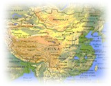 China is
bounded to the north by Russia and Mongolia; to the east by North Korea, the Yellow Sea
and the South China Sea; to the south by Vietnam, Laos, Myanmar, India, Bhutan and Nepal;
and to the west by India, Pakistan, Afghanistan, Tajikistan, Kyrgyzstan and Kazakhstan.
China has a varied terrain ranging from high plateaux in the west to flatlands in the
east; mountains take up almost one-third of the land. The most notable high mountain
ranges are the Himalayas, the Altai Mountains, the Tien Shan Mountains and the Kunlun
Mountains. On the border with Nepal is the 8848m-high (29,198ft) Mount Qomolangma (Mount
Everest). In the west is the Qinghai/Tibet Plateau, with an average elevation of 4000m
(13,200ft), known as 'the Roof of the World'. At the base of the Tien Shan Mountains is
the Turpan Depression or Basin, China's lowest area, 154m (508ft) below sea level at the
lowest point. China has many great river systems, notably the Yellow (Huang He) and
Yangtze Kiang (Chang Jiang). Only 10% of all China is suitable for agriculture. China is
bounded to the north by Russia and Mongolia; to the east by North Korea, the Yellow Sea
and the South China Sea; to the south by Vietnam, Laos, Myanmar, India, Bhutan and Nepal;
and to the west by India, Pakistan, Afghanistan, Tajikistan, Kyrgyzstan and Kazakhstan.
China has a varied terrain ranging from high plateaux in the west to flatlands in the
east; mountains take up almost one-third of the land. The most notable high mountain
ranges are the Himalayas, the Altai Mountains, the Tien Shan Mountains and the Kunlun
Mountains. On the border with Nepal is the 8848m-high (29,198ft) Mount Qomolangma (Mount
Everest). In the west is the Qinghai/Tibet Plateau, with an average elevation of 4000m
(13,200ft), known as 'the Roof of the World'. At the base of the Tien Shan Mountains is
the Turpan Depression or Basin, China's lowest area, 154m (508ft) below sea level at the
lowest point. China has many great river systems, notably the Yellow (Huang He) and
Yangtze Kiang (Chang Jiang). Only 10% of all China is suitable for agriculture.
(Top)  Land Formation and Rivers Land Formation and Rivers
 China's
land drops off in escarpments eastward to the ocean, letting in humid air current and
leading many rivers eastward. Among the rivers totaling 220,000 kilometers in length in
China, the Changjiang (Yangtze) and the Huanghe (Yellow) are world known. China's
land drops off in escarpments eastward to the ocean, letting in humid air current and
leading many rivers eastward. Among the rivers totaling 220,000 kilometers in length in
China, the Changjiang (Yangtze) and the Huanghe (Yellow) are world known.
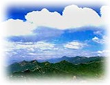
China has beautiful scenery, with mountains and ranges, highlands, plains, basins, and
hills. The highlands and hill regions account for 65 percent of the country's total land
mass, and there are more than 2,000 lakes. The highest mountain peak is Qomolangma
(Everest), the highest in the world, 8,848 meters above sea level; the lowest point is the
Turpan Basin, 154 meters below sea level. (Top)
 Climate Climate
 China is
characterized by a continental climate. The latitude spans nearly 50 degrees. The greater
part of the Chinese territory is situated in the Temperate Zone, its southern part in the
tropical and subtropical zones, and its northern part near the Frigid Zone. Temperatures
differ therefore rather strikingly across the country. The northern part of Heilongjiang
Province has long winters but no summers; while the Hainan Island has long summers but no
winters. The Huaihe River valley is marked by distinctive seasonal changes, but it is
spring all year round in the south of the Yunnan-Guizhou Plateau. In the northwest
hinterland, the temperature changes dramatically. China’s high tundra zone is
situated in the Qinghai-Tibet, where the temperature is low in all four seasons. Some
desert areas are dry all year round. China is
characterized by a continental climate. The latitude spans nearly 50 degrees. The greater
part of the Chinese territory is situated in the Temperate Zone, its southern part in the
tropical and subtropical zones, and its northern part near the Frigid Zone. Temperatures
differ therefore rather strikingly across the country. The northern part of Heilongjiang
Province has long winters but no summers; while the Hainan Island has long summers but no
winters. The Huaihe River valley is marked by distinctive seasonal changes, but it is
spring all year round in the south of the Yunnan-Guizhou Plateau. In the northwest
hinterland, the temperature changes dramatically. China’s high tundra zone is
situated in the Qinghai-Tibet, where the temperature is low in all four seasons. Some
desert areas are dry all year round.
The capital, Beijing is built as three rectangles, one within the other. The innermost
rectangle is the Forbidden City; a museum and public park, formerly the residence of the
Ming and Qing emperors. Tiananmen Square, the largest public square in the world is here
(Top)
 Population Population
 China
has the largest population in the world. In 1998, there were 1,248.1 million people living
on the mainland (excluding those living in Hong Kong, Taiwan and Macao), accounting for 22
percent of the world population. China
has the largest population in the world. In 1998, there were 1,248.1 million people living
on the mainland (excluding those living in Hong Kong, Taiwan and Macao), accounting for 22
percent of the world population.
Male ------------------ 581.82 million, 51.5 percent of the total
Female ---------------- 548.69 million, 48.5 percent of the total
Growth rate ------------ 0.77%
Birth rate ------------ 15.1 births/1,000 population
Death rate ------------ 6.98 deaths/1,000 population
Population Density: 130.4 per sq
km.
(Top)
 Ethnic
Groups (Chinese Minorites) Ethnic
Groups (Chinese Minorites)
 China is
a multiracial country with 56 ethnic groups, including Achang, Bai, Bonan, Blang, Bouyei,
Korean, Daur, Dai, De'ang, Dongxiang, Derung, Oroqen, Russian, Ewenki, Gaoshan, Gelao,
Hani, Kazak, Han, Hezhen, Hui, Jino, Gin, ingpo, Kirgiz, Lahu, Li, Lisu, Lhoba, Manchu,
Maonan, Mongolian, Monba, Miao, Mulam, Naxi, Nu, Primi, Qiang, Salar, She, Sui, Tajik,
Tatar, Tu, Tujia, Va, Uygur, Uzbek, Xibe, Yi, Yuigur, Yao, Tibetan, and Zhuang. The Han
people account for 92 percent of the population. No matter how big or small the population
is, all peoples share equal rights. China is
a multiracial country with 56 ethnic groups, including Achang, Bai, Bonan, Blang, Bouyei,
Korean, Daur, Dai, De'ang, Dongxiang, Derung, Oroqen, Russian, Ewenki, Gaoshan, Gelao,
Hani, Kazak, Han, Hezhen, Hui, Jino, Gin, ingpo, Kirgiz, Lahu, Li, Lisu, Lhoba, Manchu,
Maonan, Mongolian, Monba, Miao, Mulam, Naxi, Nu, Primi, Qiang, Salar, She, Sui, Tajik,
Tatar, Tu, Tujia, Va, Uygur, Uzbek, Xibe, Yi, Yuigur, Yao, Tibetan, and Zhuang. The Han
people account for 92 percent of the population. No matter how big or small the population
is, all peoples share equal rights.
(Top)
 Religion Religion
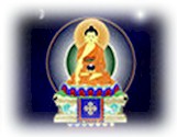 China is
a multi-religious country. Taoism, Buddhism, lslamism, Protestantism and Catholicism have
all developed quite a following in this country. Freedom of belief is a government policy,
and normal religious activities are protected by the constitution. China is
a multi-religious country. Taoism, Buddhism, lslamism, Protestantism and Catholicism have
all developed quite a following in this country. Freedom of belief is a government policy,
and normal religious activities are protected by the constitution.
(Top)
 Administrative
Units Administrative
Units
At present,China was divided into 23 provinces (Anhui, Fujian, Gansu, Guangdong, Guizhou,
Hainan, Hebei, Heilongjiang, Henan, Hubei, Hunan, Jiangsu, Jiangxi, Jilin, Liaoning,
Qinghai, Shaanxi, Shandong, Shanxi, Sichuan, Yunnan, Zhejiang, Taiwan), 5 autonomous
regions (Guangxi, Inner Mongolia, Ningxia, Xinjiang, Tibet), 4 municipalities (Beijing,
Chongqing, Shanghai, Tianjin), and 1 special administrative region (Hongkong).
(Top)
 Capital Capital
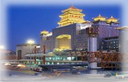 Beijing is the capital of the People's Republic of
China. A center for politics, economy and culture, Beijing has been developed into a
world-class metropolis in which the modern world is blended harmoniously with the glory of
an imperial past. (Top) Beijing is the capital of the People's Republic of
China. A center for politics, economy and culture, Beijing has been developed into a
world-class metropolis in which the modern world is blended harmoniously with the glory of
an imperial past. (Top)
 Language: Language:
 Language: The official language is
Mandarin Chinese. Among the enormous number of local dialects, in the south, large groups
speak Cantonese, Fukienese, Xiamenhua and Hakka. Mongolia, Tibet and Xinjiang, which are
autonomous regions, have their own languages. Translation and interpreter services are
good. English is spoken by many guides. Language: The official language is
Mandarin Chinese. Among the enormous number of local dialects, in the south, large groups
speak Cantonese, Fukienese, Xiamenhua and Hakka. Mongolia, Tibet and Xinjiang, which are
autonomous regions, have their own languages. Translation and interpreter services are
good. English is spoken by many guides.
Putonghua (Beijing dialect mandarin)
Religion: Officially atheist; Confucianism, Buddhism, Taoism (no stats available);
Muslim (14 million), Christian (7 million)
(Top)
 Others Others
 Telephone: IDD is
available. Country code: 86. Outgoing international code: 00. Antiquated internal service
with public telephones in hotels and shops displaying a telephone unit sign. It is often
easier to make international phone calls from China than it is to make calls internally. Telephone: IDD is
available. Country code: 86. Outgoing international code: 00. Antiquated internal service
with public telephones in hotels and shops displaying a telephone unit sign. It is often
easier to make international phone calls from China than it is to make calls internally.
Mobile telephone: GSM 1800
and 900 networks provide coverage in Beijing, Guangzhou (Canton) and Shanghai; GSM 900
networks also exist in most other major urban areas in the southeastern and eastern
regions including Chengdu and Chongqing. Networks are operated by China Telecom.
Fax: A growing number of
hotels offer fax facilities but are often incoming only. Rates are generally high.
Post: Service to Europe takes
from between two days and a week. Tourist hotels usually have their own post offices. All
postal communications to China should be addressed 'People's Republic of China'.
Press: The main
English-language daily is the China Daily and China Travel. There is also
the weekly news magazine Beijing Review, with editions in English, French, Spanish,
Japanese and German. National newspapers include The People's Daily and The
Guangming Daily, with many provinces having their own local dailies as well.
BBC World Service and Voice of America frequencies: From time to time these change.
Electricity: 220/240
volts AC, 50Hz. Two-pin sockets and some three-pin sockets are in use.
(Top)
|


 China is
bounded to the north by Russia and Mongolia; to the east by North Korea, the Yellow Sea
and the South China Sea; to the south by Vietnam, Laos, Myanmar, India, Bhutan and Nepal;
and to the west by India, Pakistan, Afghanistan, Tajikistan, Kyrgyzstan and Kazakhstan.
China has a varied terrain ranging from high plateaux in the west to flatlands in the
east; mountains take up almost one-third of the land. The most notable high mountain
ranges are the Himalayas, the Altai Mountains, the Tien Shan Mountains and the Kunlun
Mountains. On the border with Nepal is the 8848m-high (29,198ft) Mount Qomolangma (Mount
Everest). In the west is the Qinghai/Tibet Plateau, with an average elevation of 4000m
(13,200ft), known as 'the Roof of the World'. At the base of the Tien Shan Mountains is
the Turpan Depression or Basin, China's lowest area, 154m (508ft) below sea level at the
lowest point. China has many great river systems, notably the Yellow (Huang He) and
Yangtze Kiang (Chang Jiang). Only 10% of all China is suitable for agriculture.